Weather
An active, moisture-laden pattern for the Corn Belt
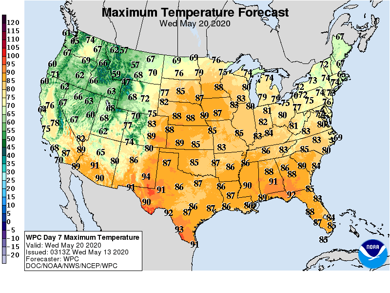
Across the Plains, Midwest, and Northeast, the weather focus will begin to shift away from below-normal temperatures. In fact, near- or above-normal temperatures will be in place by week’s end across much of the eastern half of the U.S.
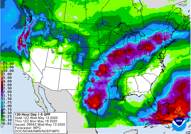
However, significant precipitation will accompany the warming trend in some areas. For example, 5-day rainfall totals could reach 2 to 4 inches or more from eastern Texas into the middle Mississippi Valley and the lower Great Lakes region. In contrast, little or no rain will fall in the Southwest and from northern Florida to Virginia. Periods of light precipitation should occur, however, from the Pacific Northwest into the upper Midwest.
Elsewhere, cool weather will remain in place across much of the West for several days, followed by a warming trend.
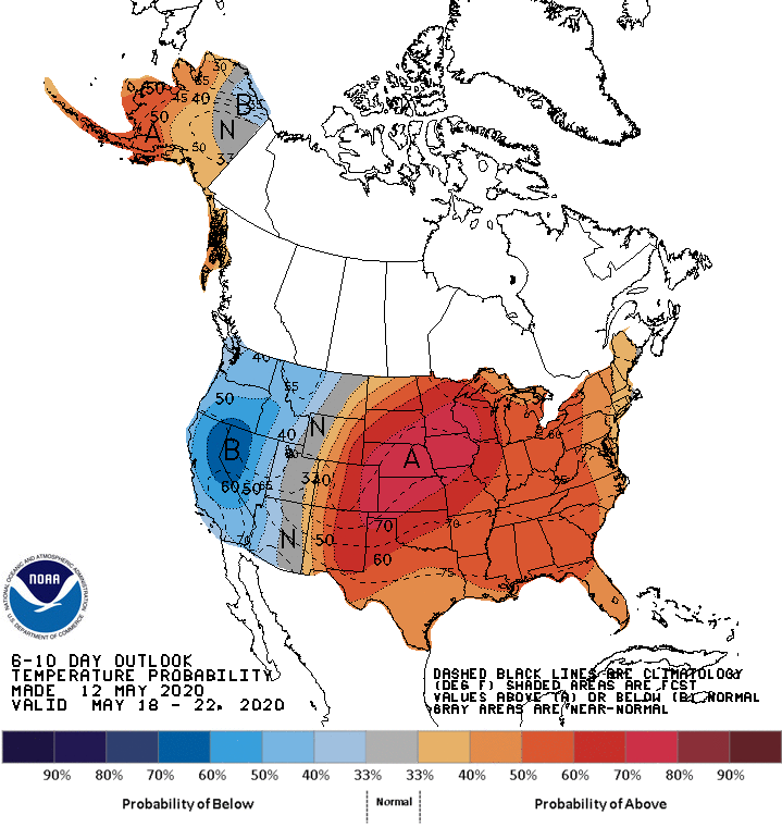
Looking ahead, the 6- to 10-day outlook calls for above-normal temperatures nationwide, except for cooler-than-normal conditions in California, the Great Basin, and the Northwest.
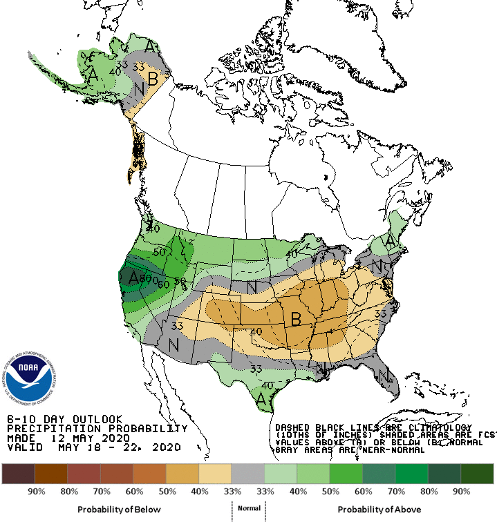
Meanwhile, near- or above-normal rainfall across most of the country should contrast with drier-than-normal weather in the central and southern sections of the Rockies and Plains.
Add Comment