Weather
Active for now, later a drier pattern for the Heartland
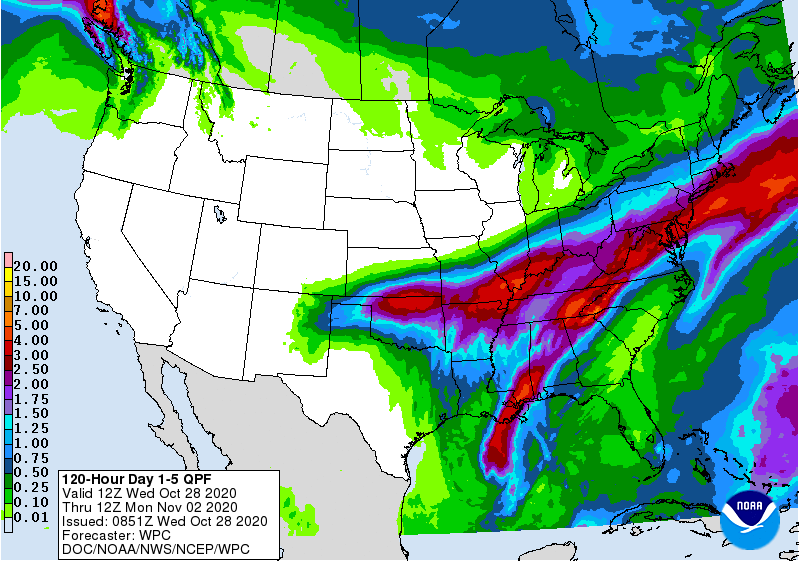
During the next 2 days, the rare interaction between a winter-like storm and a hurricane (Zeta) will generate at least 2 to 4 inches of rain across a broad area from the mid-South and the lower Mississippi Valley into the central and southern Appalachians and the mid-Atlantic.
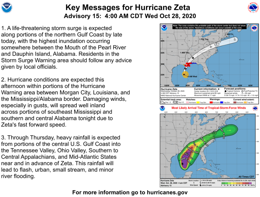
Zeta will make landfall later Wednesday in southeastern Louisiana, delivering a significant storm surge (as much as 6 to 9 feet), damaging winds, and heavy rain. Tropical storm-force winds (39 to 73 mph) could spread will inland from the central Gulf Coast into the southern Appalachians. Zeta could adversely affect some unharvested summer crops, including sugarcane and open-boll cotton.
Elsewhere, wintry weather on the southern Plains will end by Thursday, while little or no precipitation will fall during the next 5 days across the West, the northern half of the Plains, and the upper Midwest.
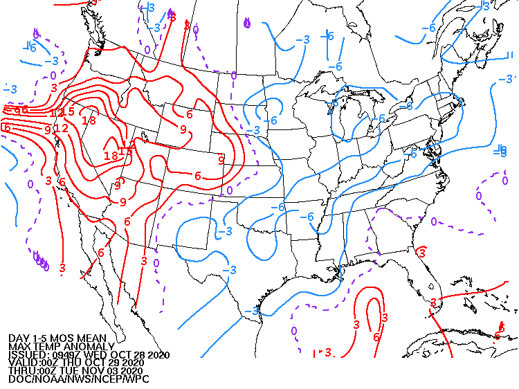
Temperatures will continue to slowly moderate, with warmer-than-normal weather gradually returning across much of the West.
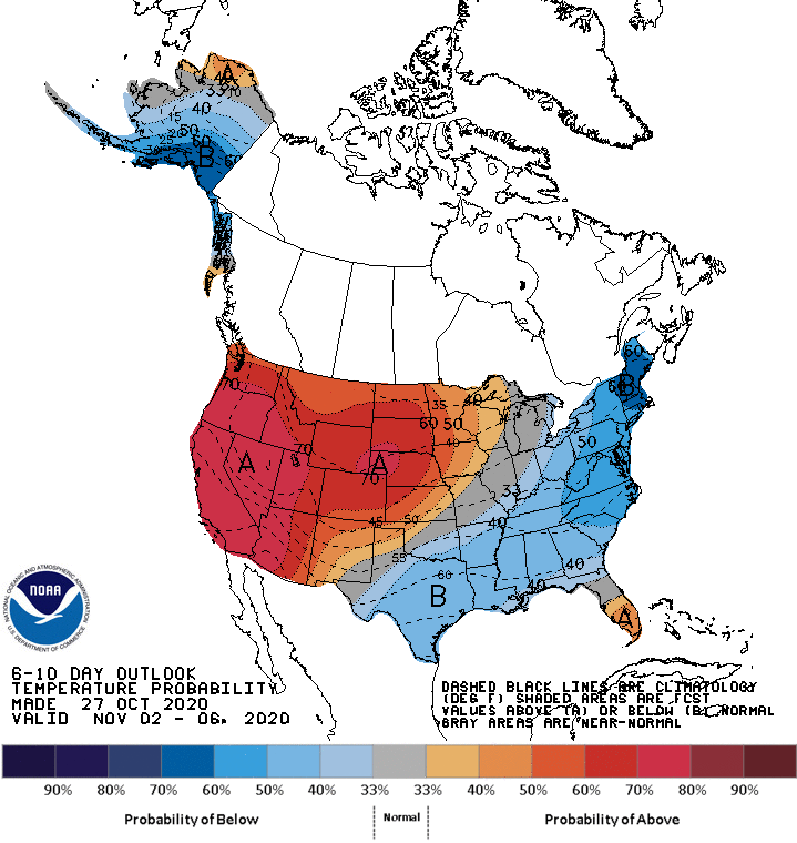
Looking ahead, the 6- to 10-day outlook calls for the likelihood of below-normal temperatures across much of the southern and eastern U.S., while warmer-than-normal weather will prevail in southern Florida and along and west of a line from the southern Rockies to Lake Superior.
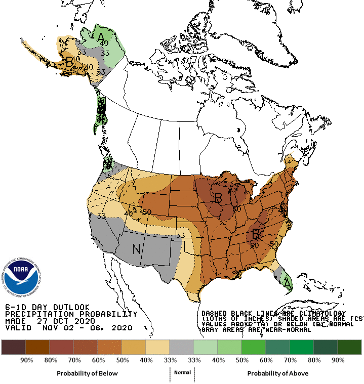
Meanwhile, near- or below-normal precipitation across most of the country should contrast with wetter-than-normal weather in western Washington and southern Florida.
Add Comment