Weather
More wet, stormy weather ahead for the Heartland

A low-pressure system over the central High Plains will drift northeastward, reaching the Great Lakes region by Sunday
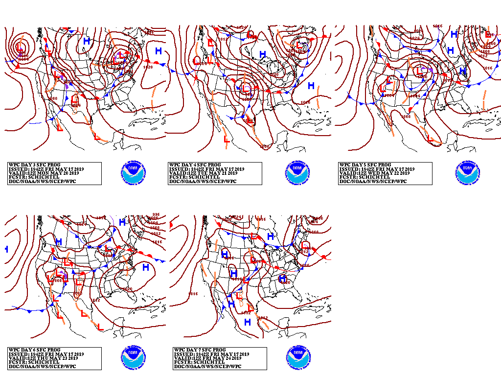
A new storm system will arrive in the West during the weekend and intensify across the central Plains early next week.
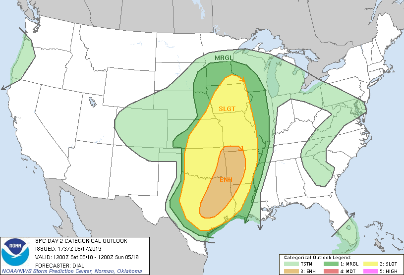
The active pattern will result in a multi-day severe weather outbreak across portions of the Plains, mid-South, and Midwest.
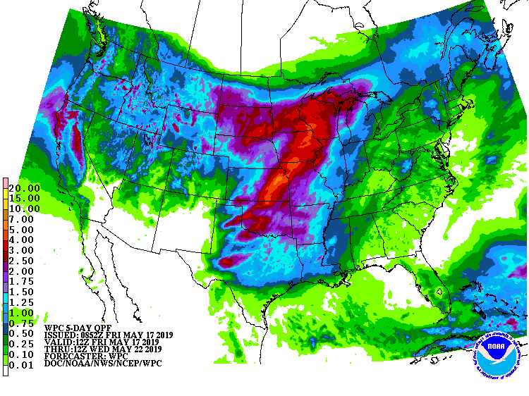
In addition, 5-day rainfall totals of 2 to 5 inches or more from the southern Plains into the upper Midwest could lead to extensive flooding, especially in the western Corn Belt.
Elsewhere, warm, mostly dry weather will prevail during the next 5 days in the southern Atlantic region, while cool, showery conditions will cover the northern two-thirds of the western U.S.
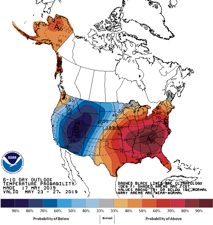
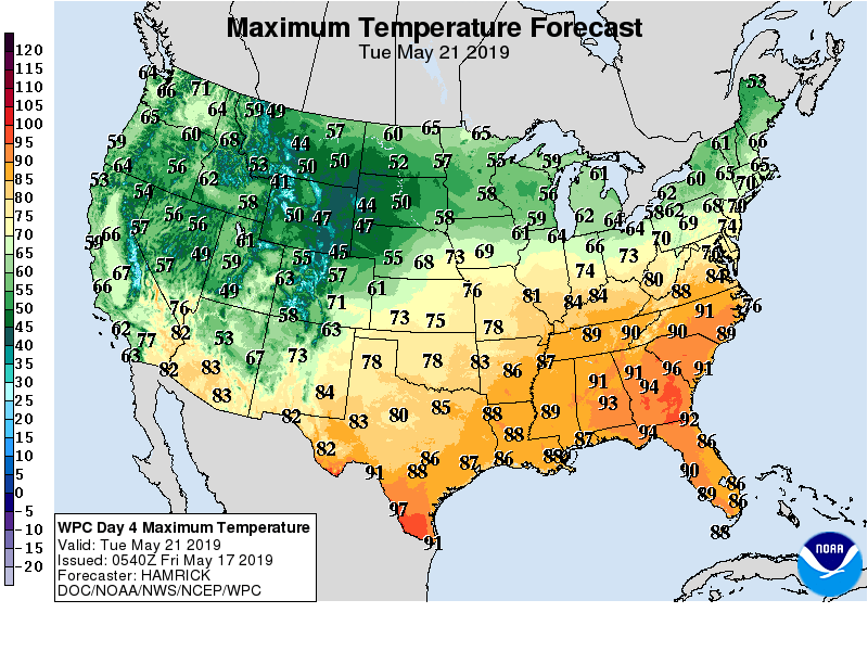
Looking ahead, the 6- to 10-day outlook calls for the likelihood of above-normal temperatures from the southern half of the Plains to the middle and southern Atlantic States, while cooler-than-normal conditions will prevail in the West and across the nation’s northern tier.
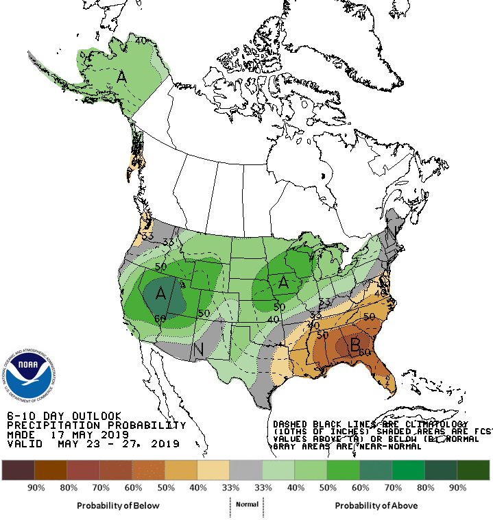
Meanwhile, below-normal rainfall in the Southeast will contrast with wetter-than-normal weather in much of the Plains, West, and Midwest.
Add Comment