Weather
A warmer, more seasonal pattern across the Heartland
Many areas of the country, including the West, North, and East, will receive little or no rainfall during the next 5 days.
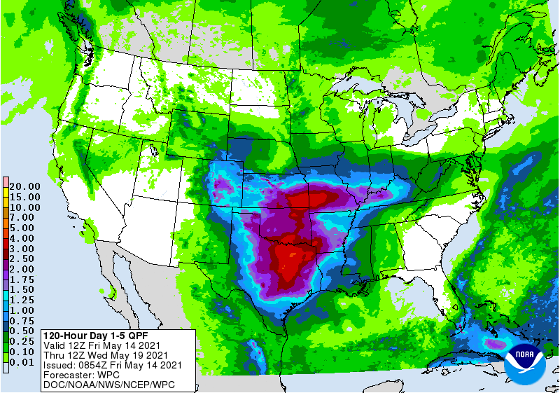
In contrast, multiple disturbances will follow a similar path across the central and southern Plains and into the middle and lower Mississippi Valley, delivering as much as 2 to 5 inches of rain. Some of the Southern rain may be produced by strong to locally severe thunderstorms.
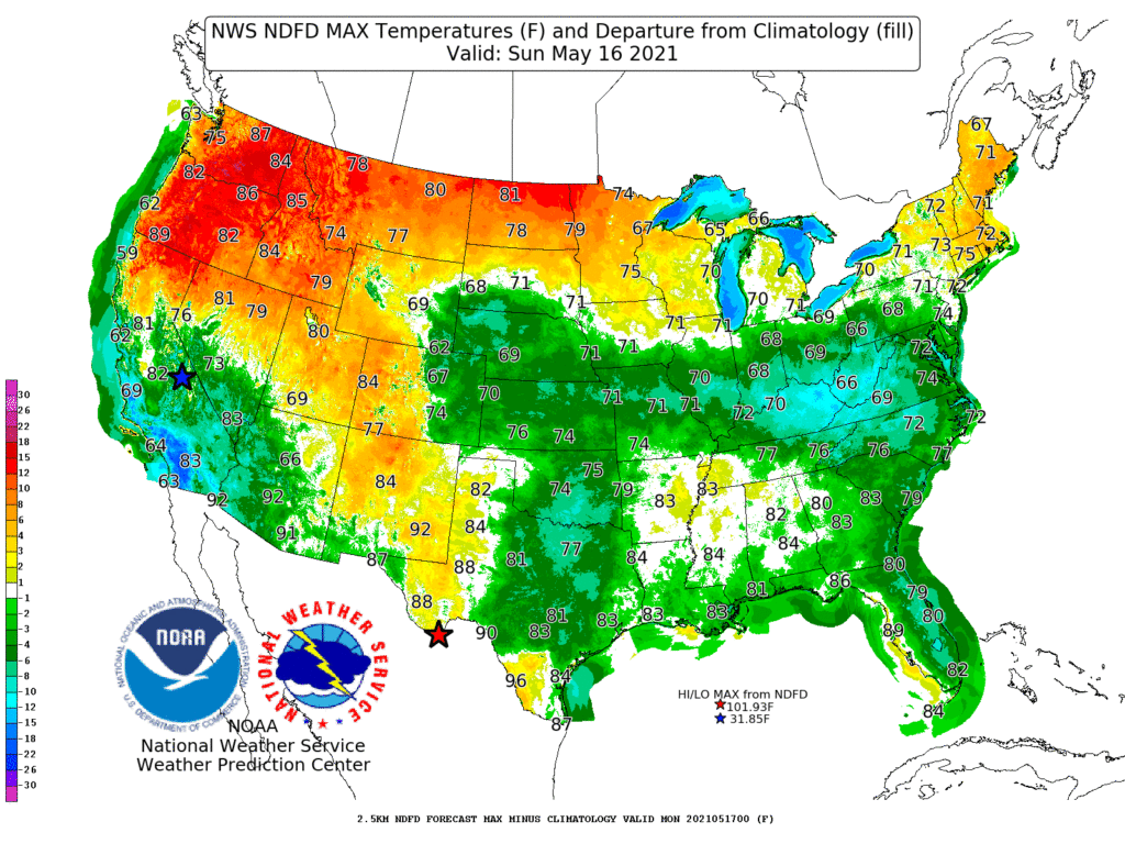
Meanwhile, temperatures across the country should remain in a relatively narrow range. For example, Southern temperatures will be slightly suppressed by rainfall and cloudiness, while Northern temperatures will climb to mostly near- or above-normal levels. During the next few days, the warmest weather—relative to normal—should cover the Northwest.

Looking ahead, the 6- to 10-day outlook calls for the likelihood of near- or above-normal temperatures nationwide, except for cooler-than-normal conditions in the Northwest and much of Texas.
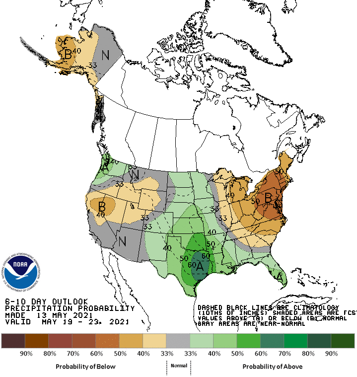
Meanwhile, near- or below-normal rainfall in the eastern Corn Belt, middle and northern Atlantic States, and much of the West should contrast with wetter-than-normal weather across the middle one-third of the U.S., the Deep South, and the Pacific Northwest.
Add Comment