Weather
A stagnant, mid-Winterlike system continues to impact the Plains, Corn Belt

Across the Corn Belt, a nearly stationary storm system centered over the upper Mississippi Valley continues to produce snow showers and strong winds. In fact, Blizzard Warnings have been expanded to cover much of the Dakotas due to low visibility in snow and blowing snow. In the storm-affected areas, conditions remain extremely stressful for livestock and difficult for rural travel. Friday’s Midwestern high temperatures will range from near 15°F in the central Dakotas to 40°F or higher in the lower Ohio Valley.
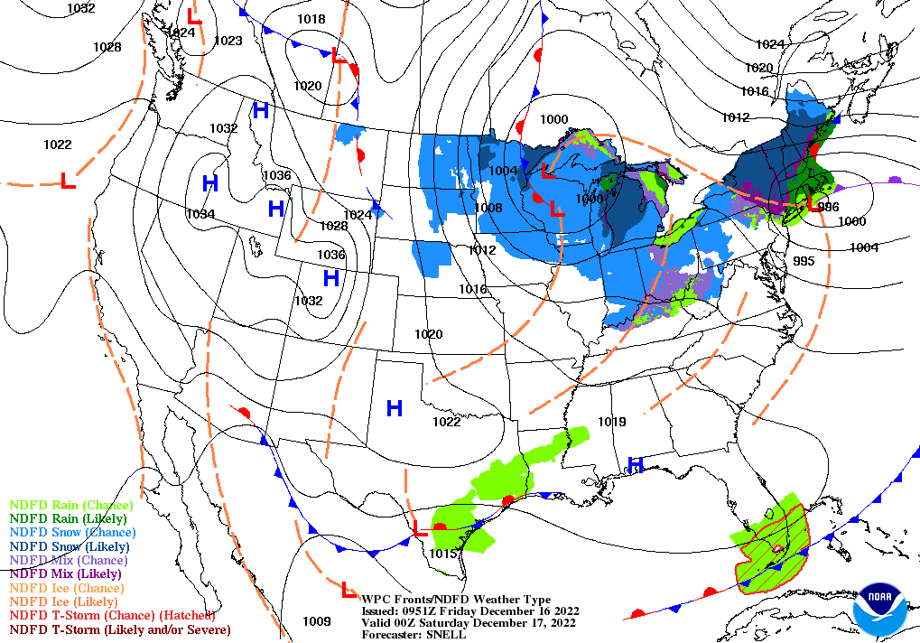
On the Plains, Blizzard Warnings are in effect Friday for northwestern Nebraska and large sections of the Dakotas, due to low visibility in wind-driven light snow and blowing snow. Frigid conditions, snow showers, and wind gusts up 50 mph are maintaining stressful conditions for livestock and hampering rural travel. During the multi-day storm, which began on December 13, Bismarck, North Dakota, has reported more than 17 inches of snow, along with a peak wind gust to 52 mph. Elsewhere, cool, dry weather prevails on the central and southern Plains.
In the South, cool, dry weather follows the December 13-15 severe weather outbreak, which spawned more than 50 tornadoes from Texas to Florida, based on preliminary reports. Early Friday, any lingering showers are confined to southern Florida.
In the West, Freeze Warnings were in effect for the third consecutive morning in much of California’s San Joaquin Valley. Freezes also occurred early Friday in parts of southern and western Arizona. The remainder of the West is also experiencing cool, dry weather. Air stagnation and foggy conditions are plaguing portions of the Northwest.
Add Comment