Weather
A shift to colder weather for parts of the Heartland
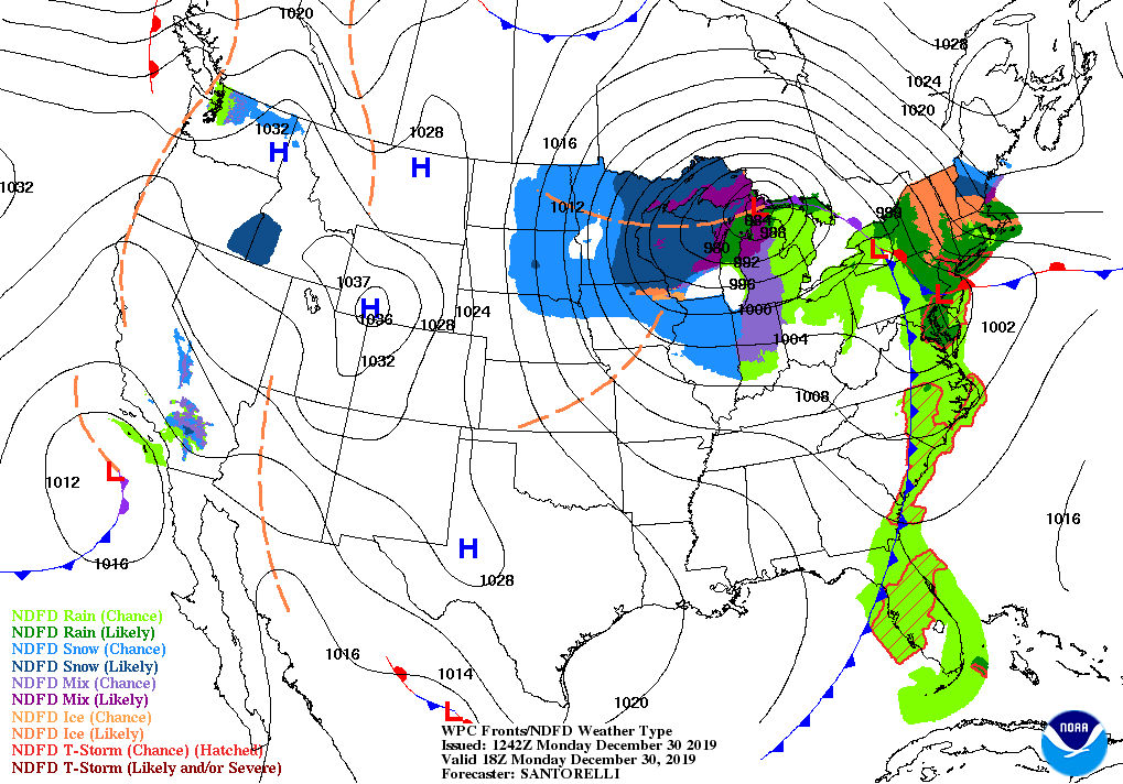
A storm system over the Great Lakes region will remain nearly stationary for the remainder of Monday, leading to showery, breezy conditions across much of the Midwest. Parts of Michigan and Wisconsin will receive significant, wind-driven snow.
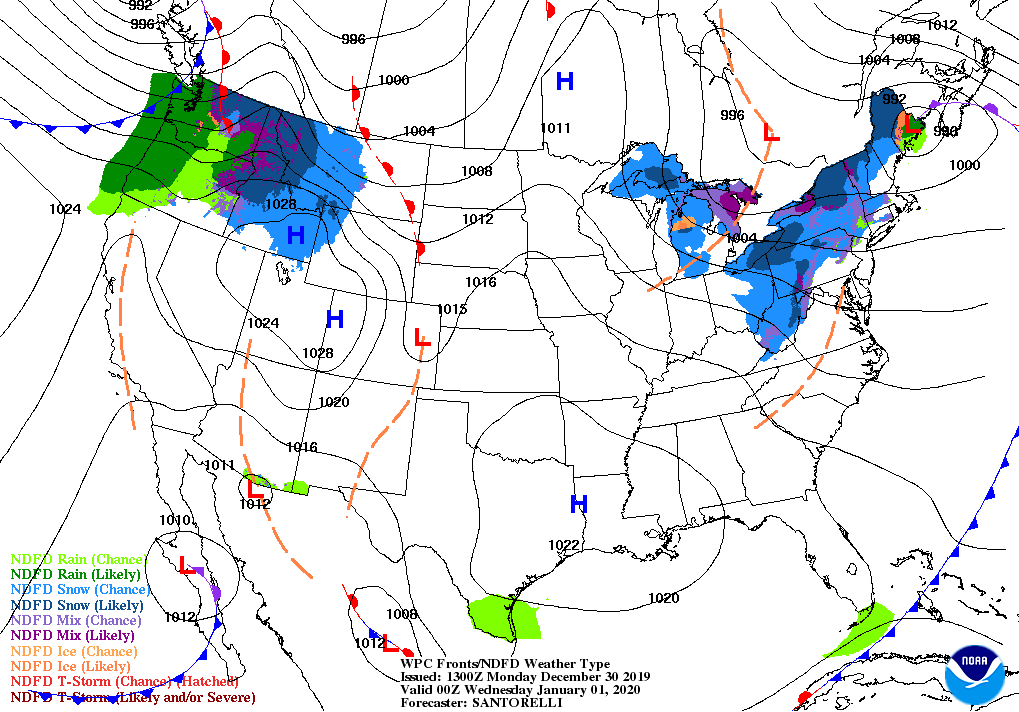
By Tuesday, the storm will begin to re-form along the northern Atlantic Coast, resulting in heavy snow across northern Maine. Meanwhile, periods of heavy snow will arrive on Tuesday and continue for the remainder of the week across portions of the Cascades and northern Rockies.

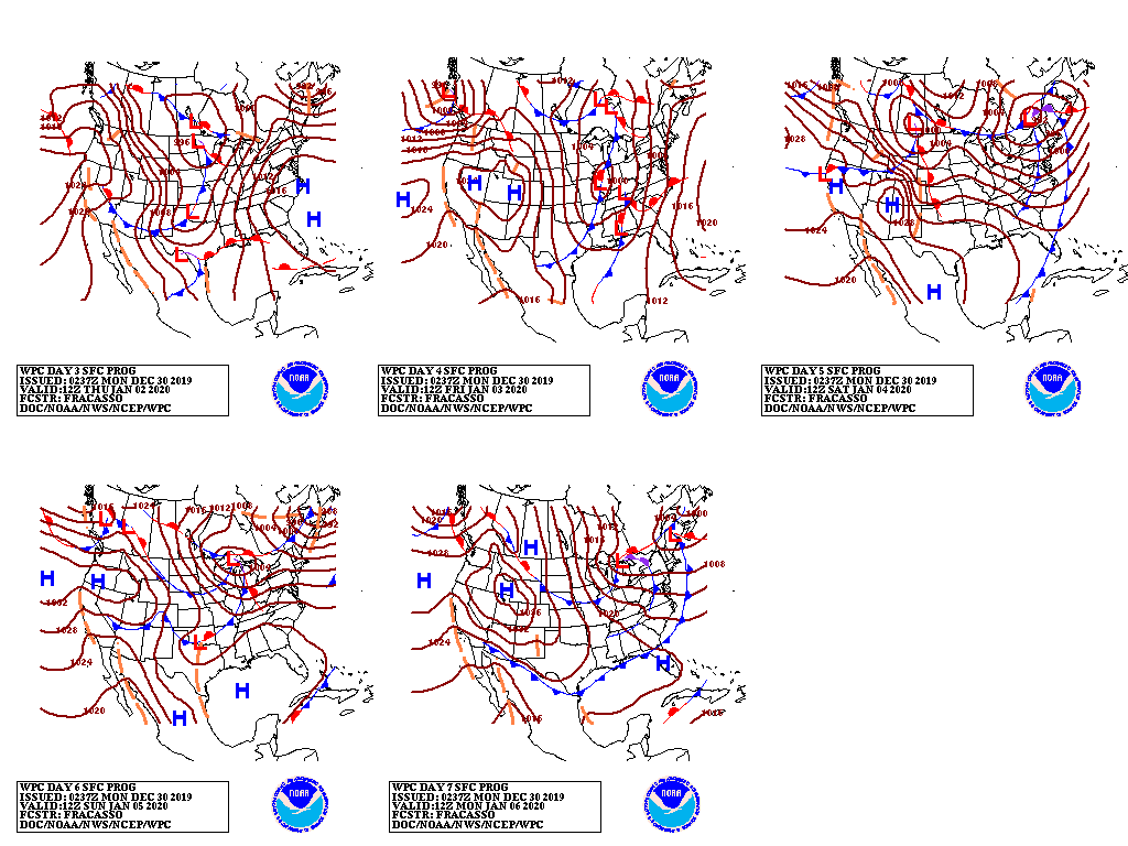
Elsewhere, the storm currently affecting southern California will cross northern Mexico before moving northeastward into the Corn Belt. As a result, late-week snow may occur in the upper Midwest, while rain should return across the South, East, and lower Midwest.
Looking ahead, the 6- to 10-day outlook calls for the likelihood of below-normal temperatures from the Pacific Coast to the Rockies and northern High Plains, while warmer-than-normal weather will be confined to the lower Rio Grande Valley and areas along the Atlantic Seaboard.
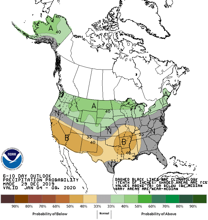
Meanwhile, wetter-than-normal conditions across the North should contrast with near- or below-normal precipitation from California to the middle and southern Atlantic States.
Add Comment