Weather
A more season pattern to return to the Heartland

Precipitation across the eastern one-third of the U.S. will largely end later Thursday. However, lowland flooding and muddy conditions will persist for several days, especially across the South.
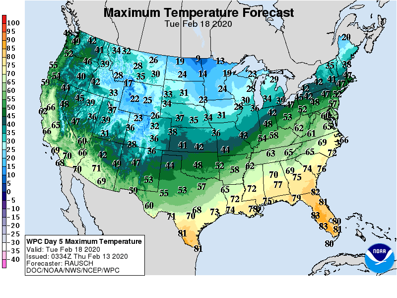
Meanwhile, weekend temperatures across the Plains, Midwest, and Northeast will start to rebound, following a sharp but short-lived cold outbreak. Temperatures will be slower to recover across the nation’s northern tier, where subsequent surges of cold air will arrive late in the weekend and early next week.
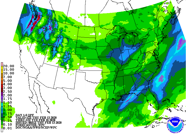
Precipitation will return across the Northwest, starting later Thursday, and continue through the weekend. In contrast, dry weather will prevail during the next 5 days from central and southern California to the southern Plains.
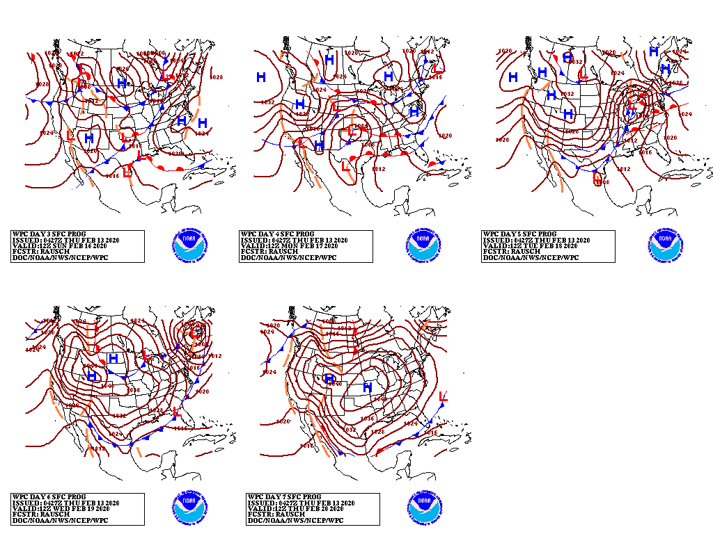
Early next week, snow will develop across the northern Plains and spread eastward across the nation’s northern tier.
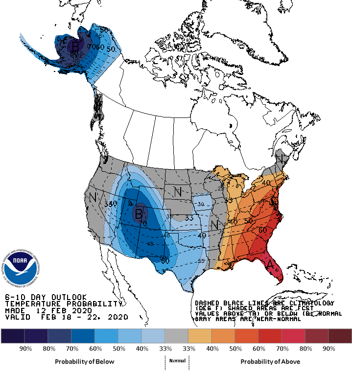
Looking ahead, the 6- to 10-day outlook calls for the likelihood of near- or below-normal temperatures in northern New England and west of the Mississippi River, while warmer-than-normal weather will prevail in much of the East.
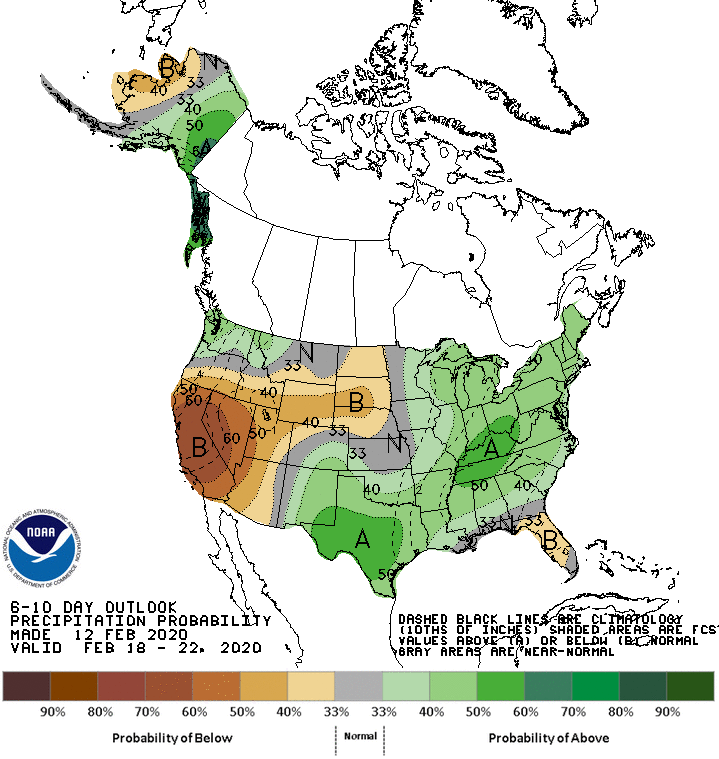
Meanwhile, near- or below-normal precipitation across Florida, the northern half of the Plains, and much of the West should contrast with wetter-than-normal weather in the Pacific Northwest, southern sections of the Rockies and Plains, and most areas from the Mississippi Valley to the East Coast.
Add Comment