Weather
A more active, wintry pattern for the Heartland
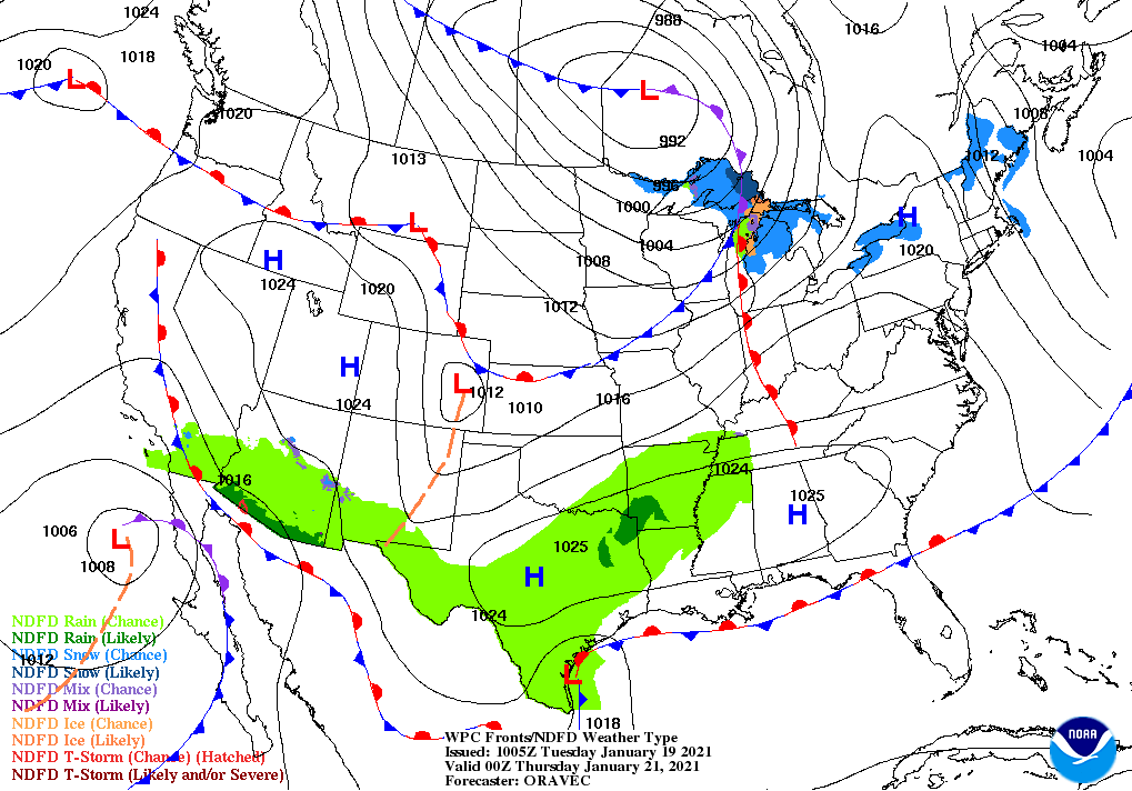
A disturbance currently producing beneficial precipitation in the Southwest will drift southward for a couple of days before turning eastward late in the week. As a result, precipitation will largely withdraw from the southwestern U.S., except for lingering rain and snow showers near the U.S.-Mexican border.
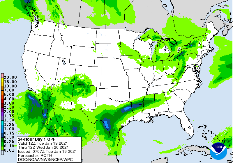
By Thursday and Friday, rain will become for focused across the South, including the Mississippi Delta, where storm-total rainfall could reach 1 to 2 inches or more.
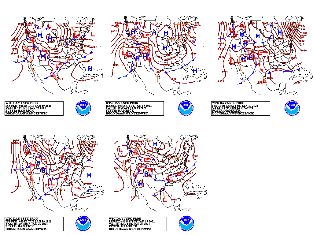
Toward week’s end, a new Western storm system—dropping southward along the Pacific Coast—may provide limited drought relief in California, the Great Basin, and the Southwest.
Meanwhile, most of the country will continue to experience an absence of extreme cold, although sub-zero temperatures may briefly affect the upper Midwest late in the week.

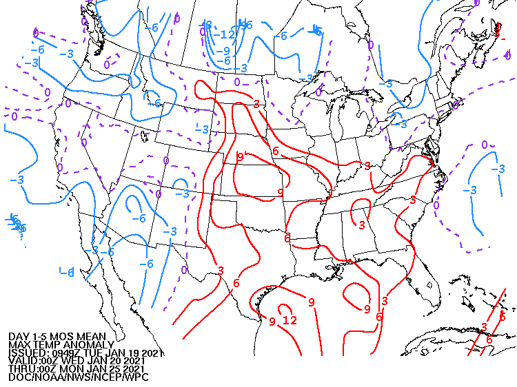
Looking ahead, the 6- to 10-day outlook calls for the likelihood of above-normal temperatures in the South, while colder-than-normal conditions will cover the northern Plains and the West.
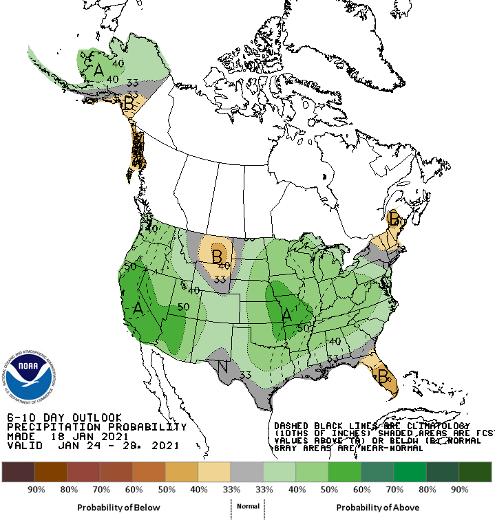
Meanwhile, below-normal precipitation across northern New England, the northern High Plains, and Florida’s peninsula should contrast with wetter-than-normal weather in most other areas of the country.
Add Comment