Weather
A mild weather pattern to cover most of the Heartland
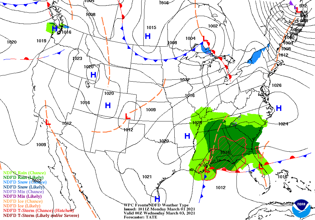
Rain across the South will linger through Tuesday, leading to additional flood-related concerns. Along the southern Atlantic Coast, showers may persist into Wednesday.

Subsequently, tranquil weather will prevail nearly nationwide during the mid- to late-week period, although chilly conditions in the East will contrast with above-normal temperatures in the western and central U.S.
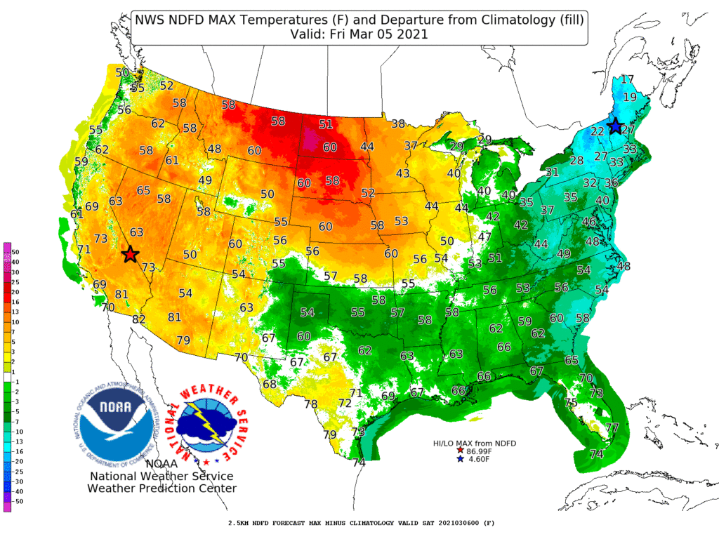
On the Plains, late-week temperatures could reach 60° as far north as eastern Montana and the western Dakotas. Meanwhile, late-week readings will remain below 32° in northern sections of New York and New England.
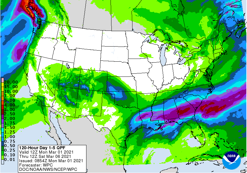
During the second half of the week, some light precipitation may develop across the southwestern and south-central U.S. Toward week’s end, precipitation should return across the Pacific Northwest.
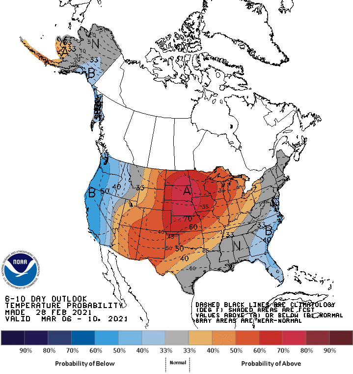
Looking ahead, the 6- to 10-day outlook calls for the likelihood of near- or above-normal temperatures nationwide, except for cooler-than-normal conditions in the Pacific Coast States and along the southern Atlantic Coast.
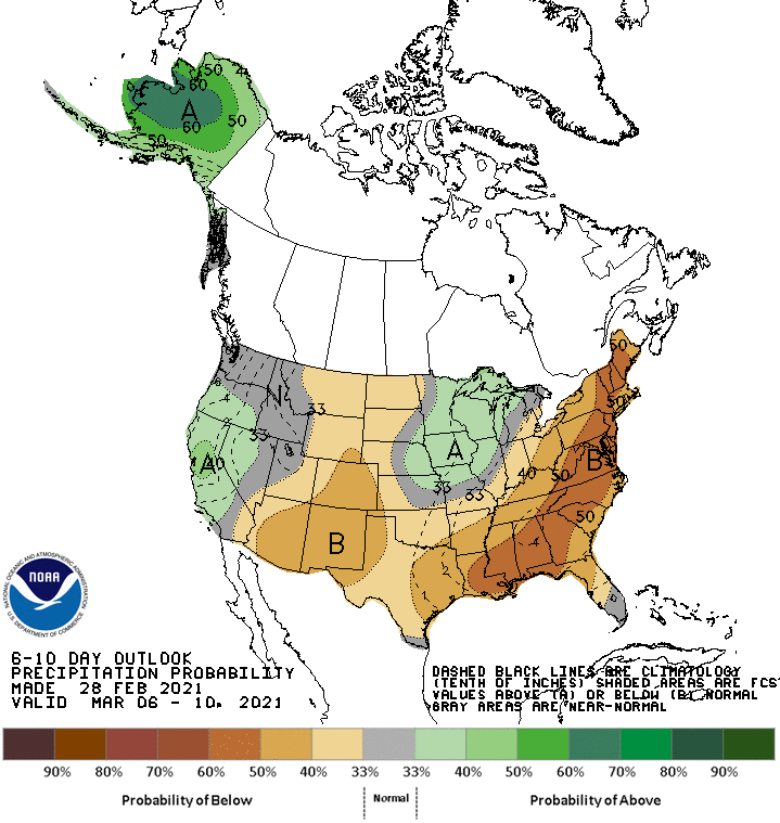
Meanwhile, near- or below-normal precipitation across most of the country should contrast with wetter-than-normal weather in the upper Midwest and northern and central California and environs.
Add Comment