Weather
A major pattern shift ahead for the Heartland
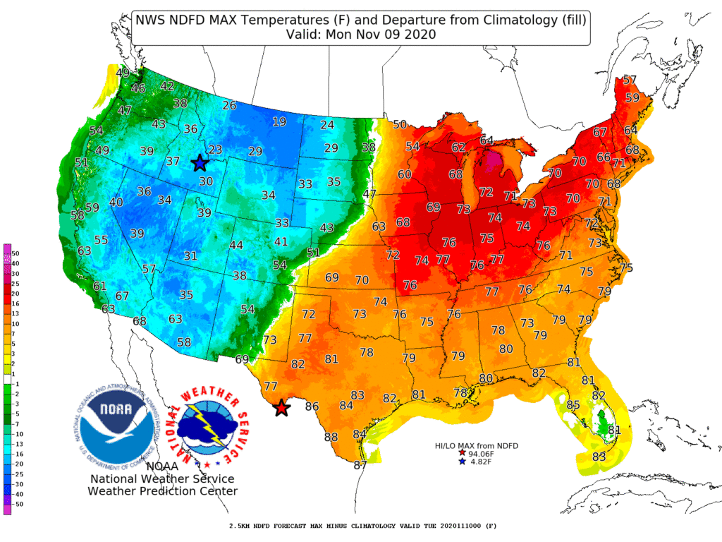
A weather pattern featuring mostly dry conditions and coast-to-coast warmth will undergo some significant changes during the next few days.
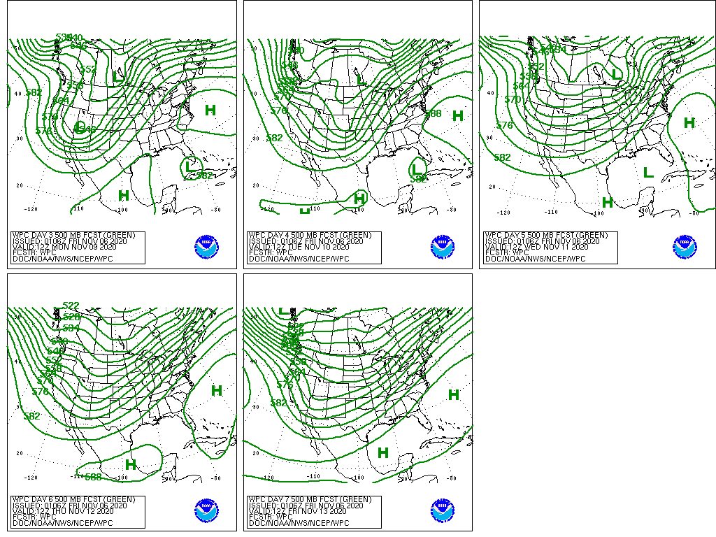
Warm, dry weather will continue, however, during the next 5 days in most areas from the Mississippi Valley eastward, while cool, wetter-weather will gradually overspread the West. By early next week, cool air will also reach the Plains, preceded and accompanied by scattered showers.
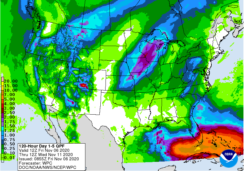
Five-day precipitation totals could reach 1 to 2 inches or more in scattered locations across the West, mainly in the Cascades, Sierra Nevada, Rockies, and Four Corners region. Significant snow may fall during the weekend across northern sections of the Rockies and High Plains. By early next week, showers and thunderstorms may erupt across portions of the central and southern Plains and Midwes
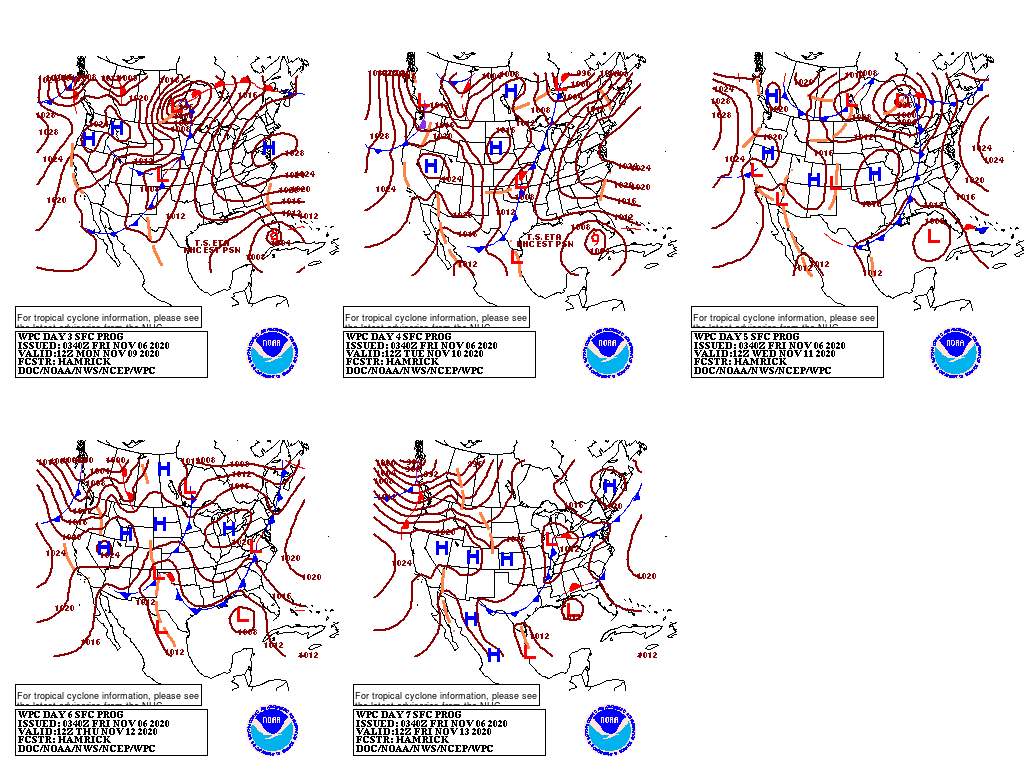
In the tropics, the remnants of Hurricane Eta may drift toward southern Florida early next week, bringing the possibility of gusty winds and heavy rain.
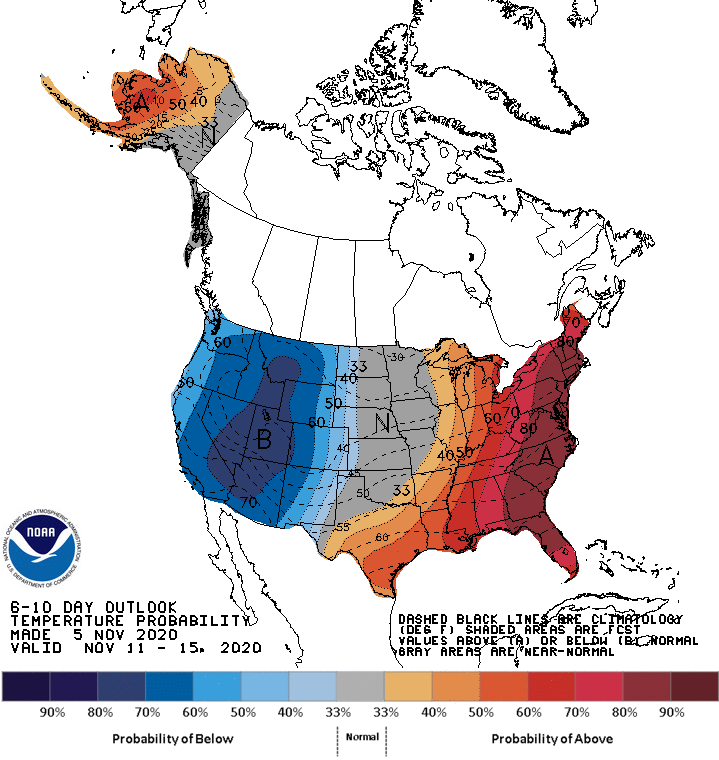
Looking ahead, the 6- to 10-day outlook calls for the likelihood of above-normal temperatures in the western Gulf Coast region and across the eastern one-third of the U.S., while colder-than-normal conditions will cover areas from the Pacific Coast to the Plains.
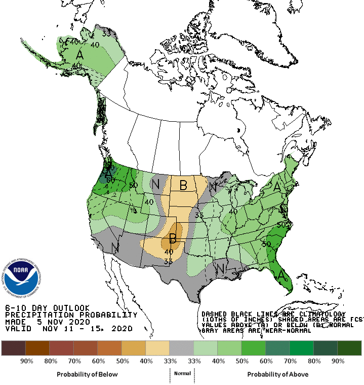
Meanwhile, near- or above-normal precipitation across most of the country should contrast with drier-than-normal weather on the northern Plains.
Add Comment