Weather
A major, early-spring storm to sweep the Heartland
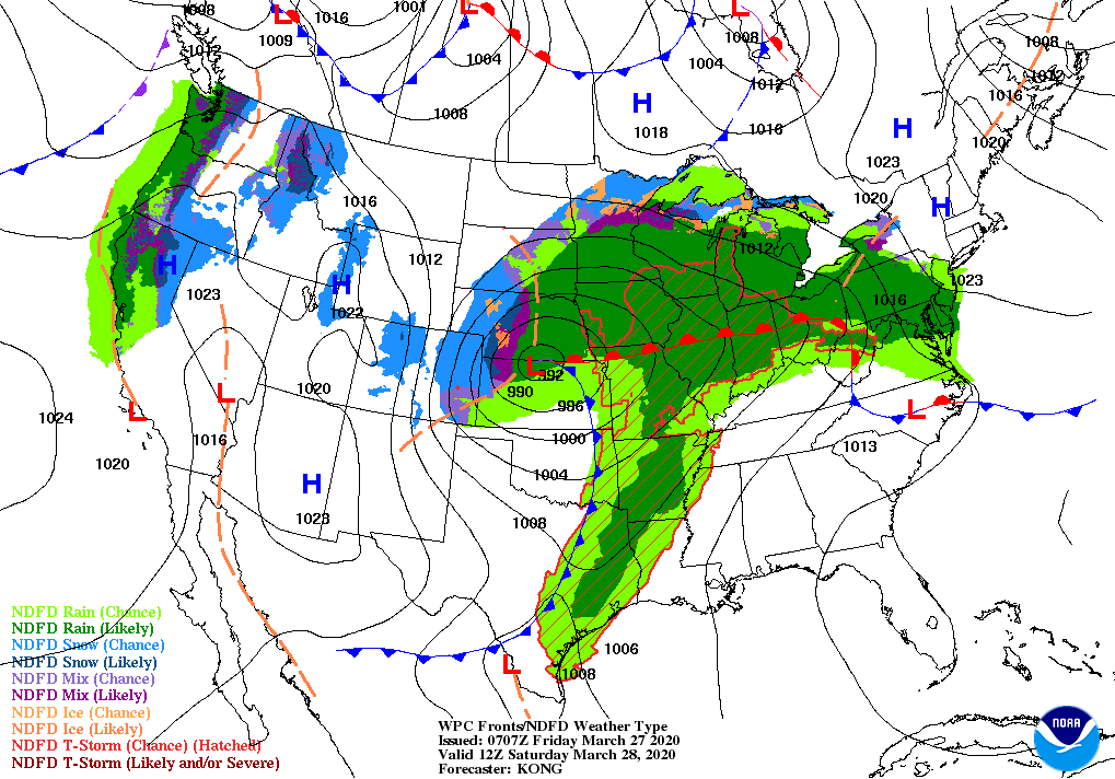
During the next couple of days, a strong spring storm system will result in a variety of weather hazards from the nation’s mid-section into the Northeast.
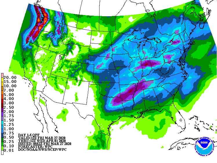
Five-day precipitation totals could reach 1 to 3 inches or more across much of the Midwest, mid-South, and Northeast, possibly causing flash flooding and increasing river flooding. Weekend snow accumulation may occur in the upper Great Lakes region and across northern New England.
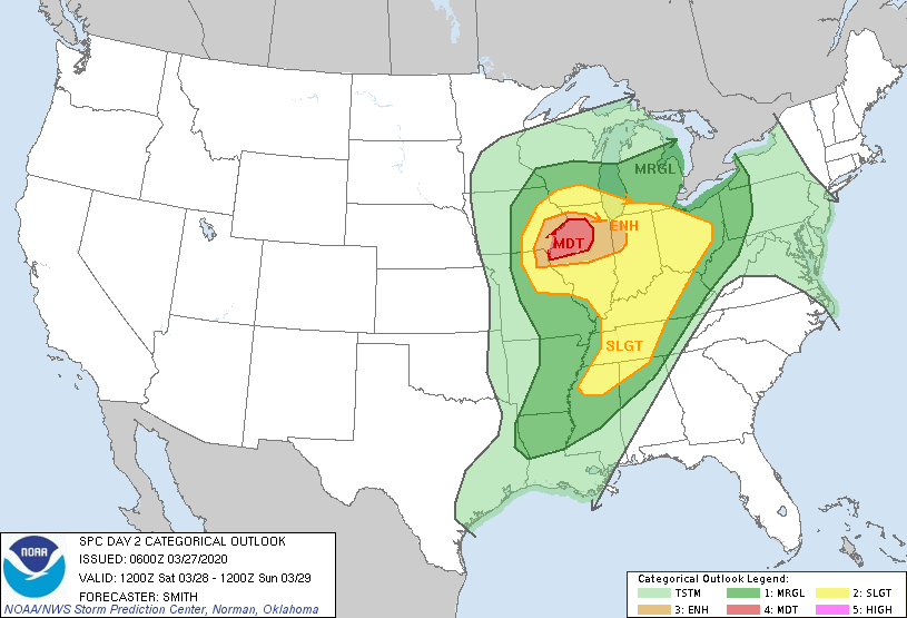
Meanwhile, locally severe thunderstorms will sweep across the South and may occur as far north as the southern Corn Belt.
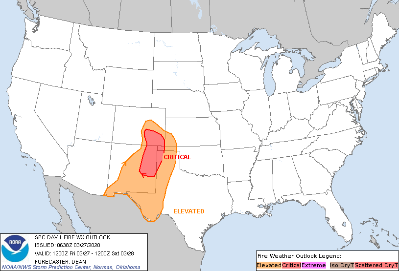
Elsewhere, an elevated risk of grassfires will persist across the southern High Plains.
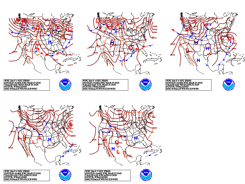
By early next week, a new pair of storms will begin to affect the country; one system will develop over the south-central U.S., while the other will arrive in the Northwest. However, little or no rain will fall during the next 5 days in the southern Atlantic States.
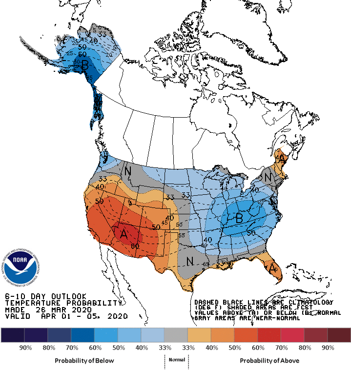
Looking ahead, the 6- to 10-day outlook calls for the likelihood of near- or below-normal temperatures in much of the eastern one-half of the U.S. and across the nation’s northern tier, except Maine. Warmer-than-normal weather can be expected in Maine, along with Florida, the Gulf Coast region, and an area stretching from California to the High Plains.
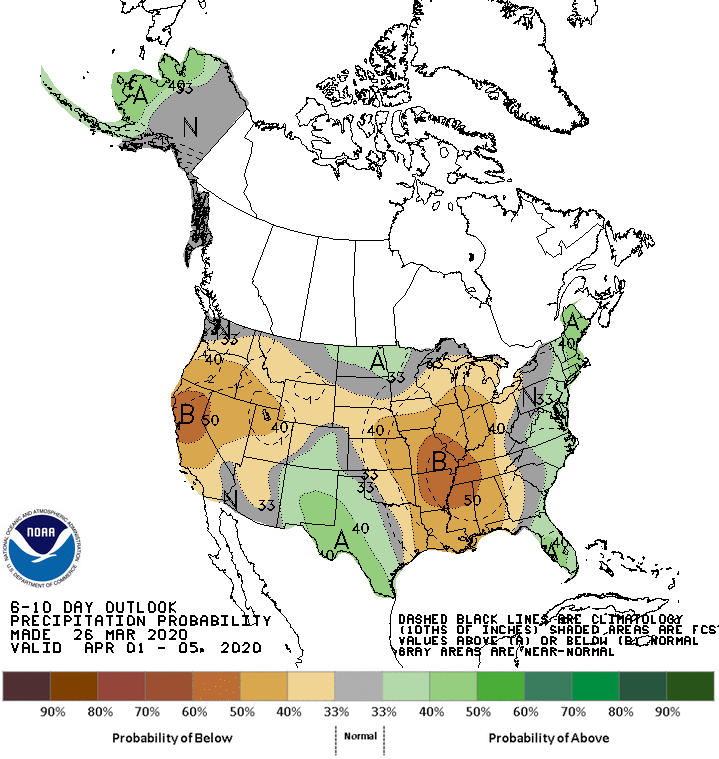
Meanwhile, near- or below-normal precipitation across large sections of the country should contrast with wetter-than-normal conditions along the Canadian border from the northernmost Rockies into the upper Great Lakes region, and across the South from Texas to the southern Atlantic Coast.
Add Comment