Weather
A favorable pattern shift ahead for the Heartland
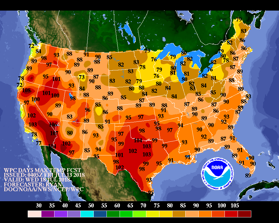 A surge of cool air will arrive across the northern Plains during the weekend and expand to cover much of the eastern half of the U.S. by the middle of next week. Hot, dry weather will persist, however, across northern California and the Northwest, and develop in the south-central U.S.
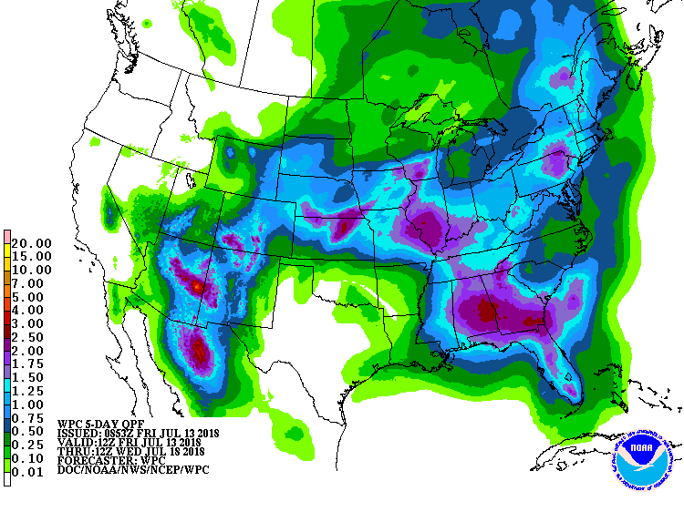 Meanwhile, the interaction between the Southwestern monsoon circulation and several cold fronts will lead to “ring of fire” showers in an arc across the Four Corners States, the central Plains, the middle Mississippi Valley, and the Southeast, with 5-day rainfall totals reaching 1 to 3 inches in many locations. Occasional showers will also affect the Northeast.
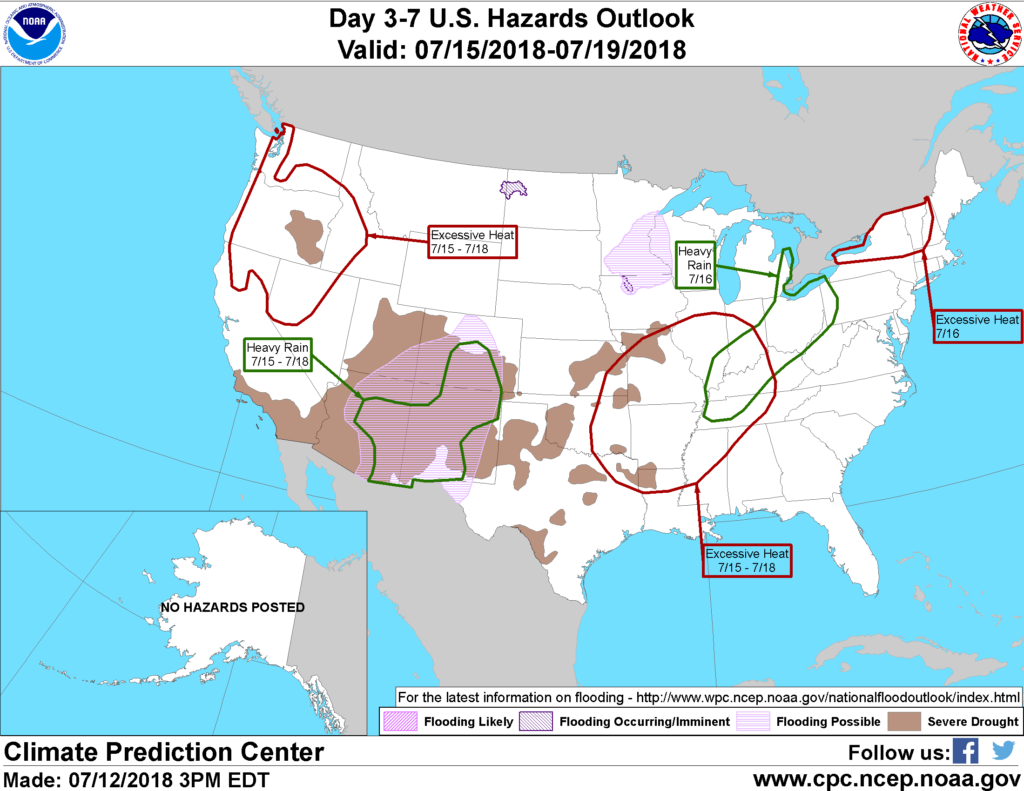 Looking ahead, the 6- to 10-day outlook calls for the likelihood of near- to below-normal temperatures across the northern and central Plains and the Midwest, while hotter-than-normal weather will prevail in the West, Deep South, and Atlantic Coast States. Meanwhile, near- to above-normal rainfall across much of the country should contrast with drier-than-normal conditions in southern Texas, the Great Lakes region, the northern High Plains, and the Northwest.
Add Comment