Weather
A cold, active pattern for much of the Heartland
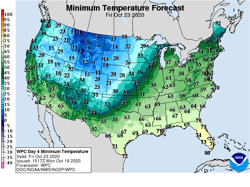
A cold weather regime across the Northwest, northern Plains, and upper Midwest will further deepen as the week progresses. In fact, temperatures near or below 0° may occur toward week’s end across northern sections of the Rockies and High Plains.
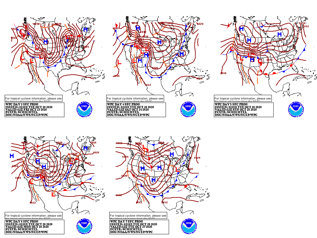
Periods of precipitation, including widespread snow, will accompany the cold outbreak. In contrast, dry weather will prevail during the next 5 days from California to the southern half of the High Plains.
Much of that region will experience unusually warm weather, but colder air will drive southward late in the week across the Plains. Meanwhile, warm weather will prevail for much of the week in the Southeast and along the Atlantic Coast.
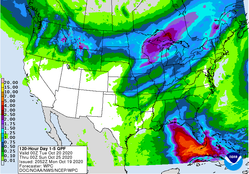
Five-day rainfall totals may reach 1 to 2 inches in the Midwest, while locally heavy showers across southern Florida may edge northward later in the week.
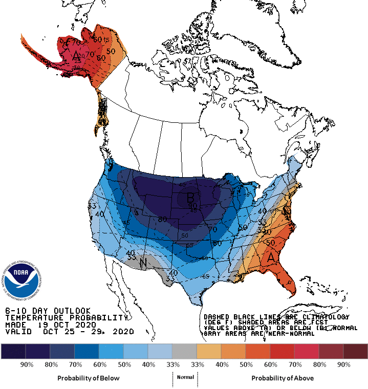
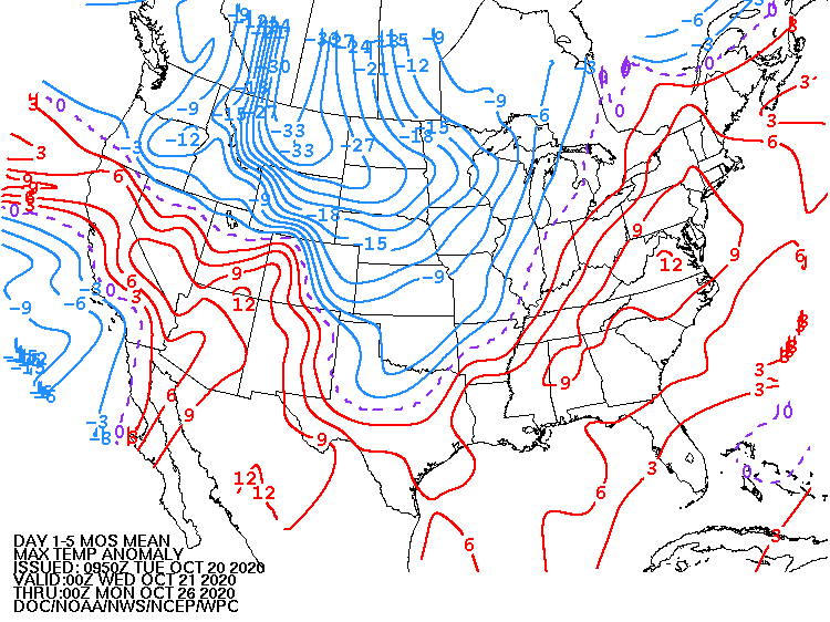
Looking ahead, the 6- to 10-day outlook calls for the likelihood of below-normal temperatures across the Plains, West, and upper Midwest, while warmer-than-normal weather will be confined to the South and parts of the East.
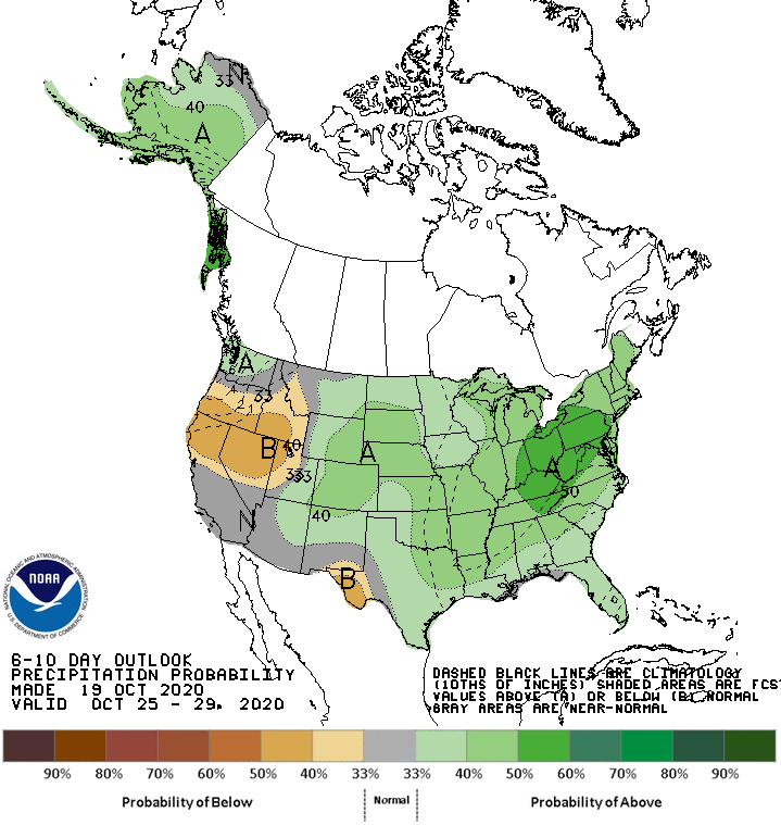
Meanwhile, near- or above-normal precipitation will occur nearly nationwide; drier-than-normal conditions should be limited to southern sections of the Rockies and High Plains.
Add Comment