Weather
A big change in weather ahead for the Heartland
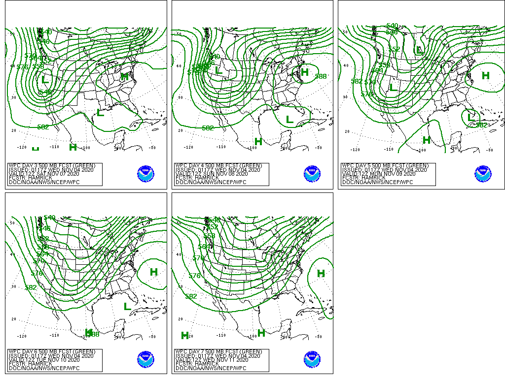
A significant weather pattern change in the West will lead to the arrival of colder weather and an increase in shower activity.
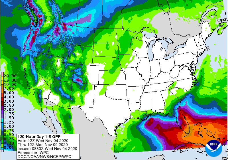
By week’s end, rain and snow showers could spread as far south as California, the Great Basin, and the Southwest, although the heaviest precipitation will fall in the northern Rockies and the Pacific Northwest.
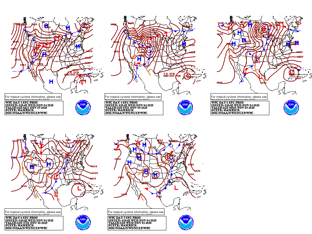
Meanwhile, warmth will continue to expand eastward, encompassing the central and eastern U.S. for several days. During the weekend, cold, snowy weather may return across the northern Plains, but much of the South, East, and Midwest will remain warm and dry.
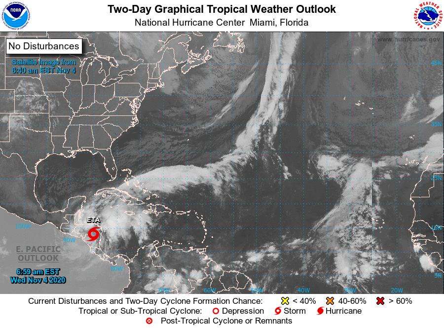
In the tropics, however, the remnants of Hurricane Eta may contribute to increasingly wet, windy weather in Florida and environs, with heavy rain possible in some areas if the tropical cyclone remains intact after spending several days over Central America.
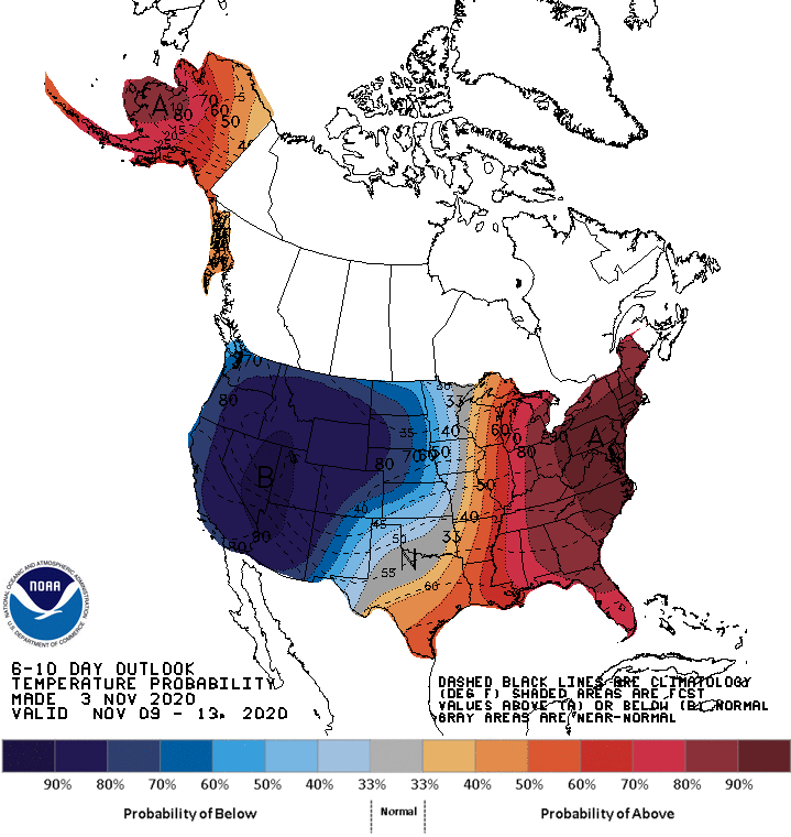
Looking ahead, the 6- to 10-day outlook calls for the likelihood of above-normal temperatures in the western Gulf Coast region and from the Mississippi Valley to the East Coast, while colder-than-normal conditions will prevail from the Pacific Coast to the Plains.
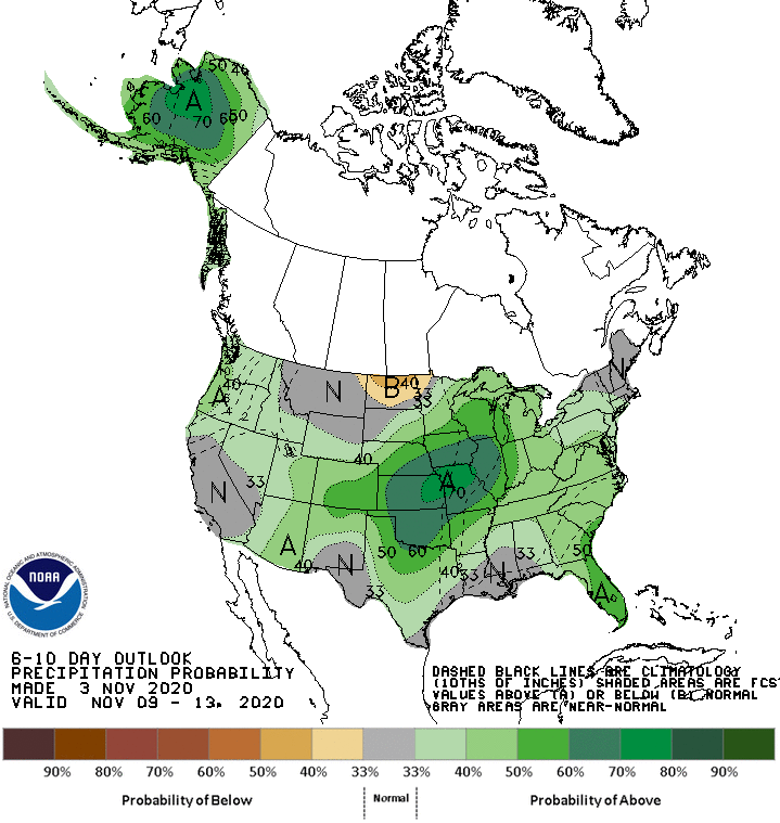
Meanwhile, near- or above-normal precipitation across most of the country should contrast with drier-than-normal weather in a small area centered over North Dakota.
Add Comment