Post
A big change in weather ahead for the Heartland
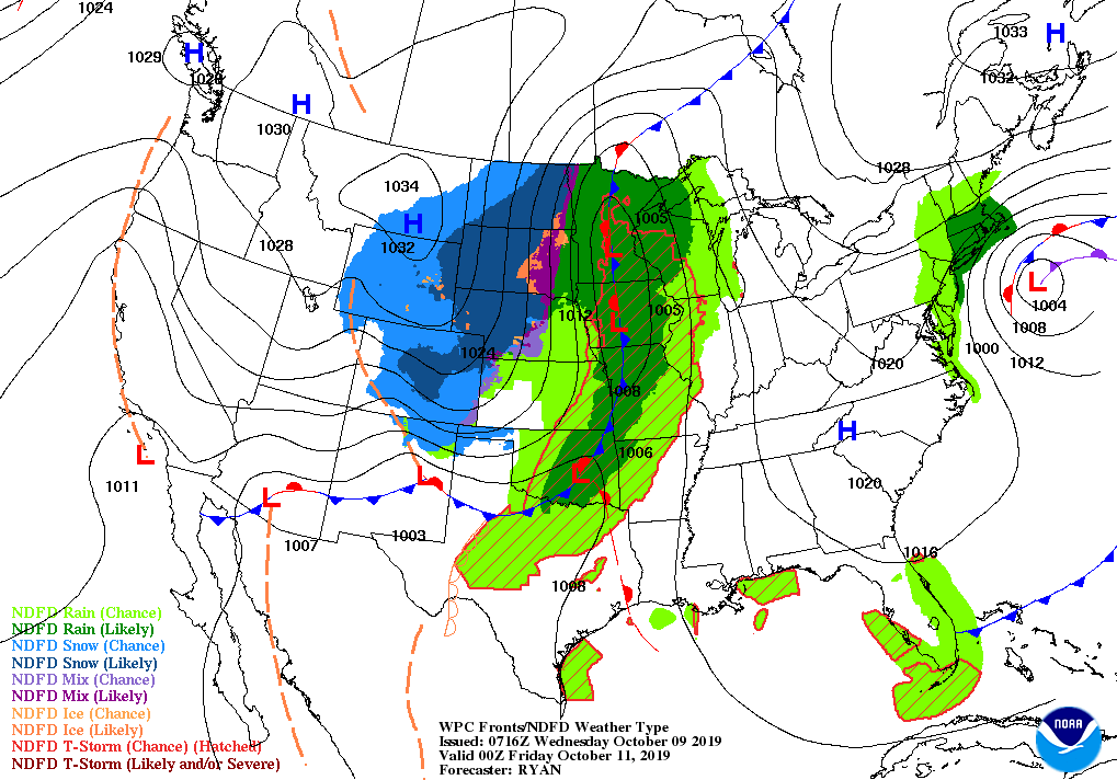
A winter-like storm will continue to evolve during the next few days. Later Wednesday and early Thursday, a low-pressure system will cross the central Rockies and central Plains. On Friday and Saturday, the storm will stall in the vicinity of northern Minnesota, leading to a prolonged period of wind-driven snow across the northern Plains and far upper Midwest.
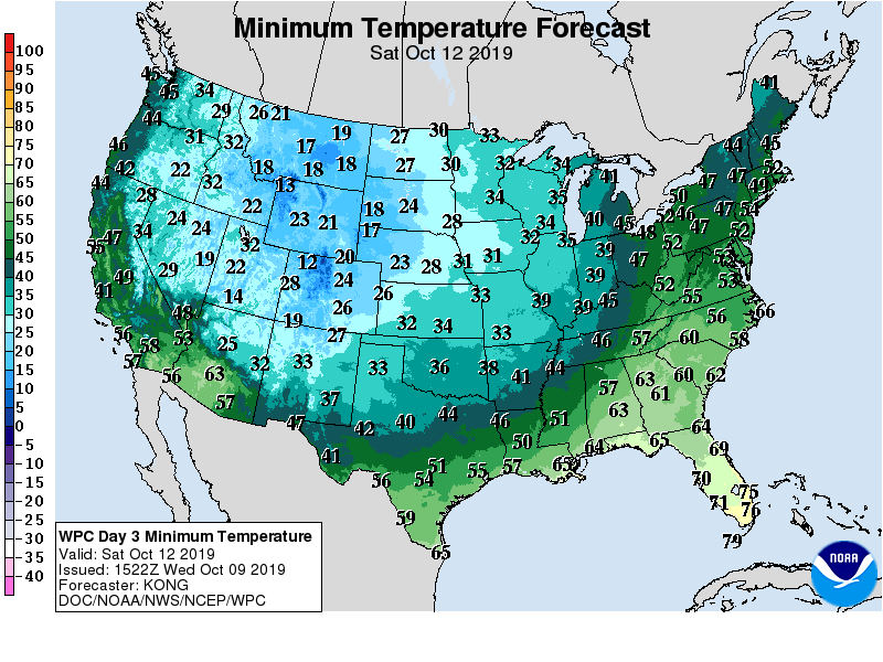
In the storm’s wake, weekend freezes can be expected along and northwest of a line from Texas’ northern panhandle to southeastern Wisconsin, effectively ending the 2019 growing season in those areas.

Farther east, a low-pressure system lurking near the East Coast could result in heavy rain in southern coastal New England, as well as gusty winds and heavy surf across a broader area of the Atlantic Seaboard.
Elsewhere, an elevated wildfire threat will persist for several days in parts of California, while cold weather will linger into next week across the northern Plains and Midwest.
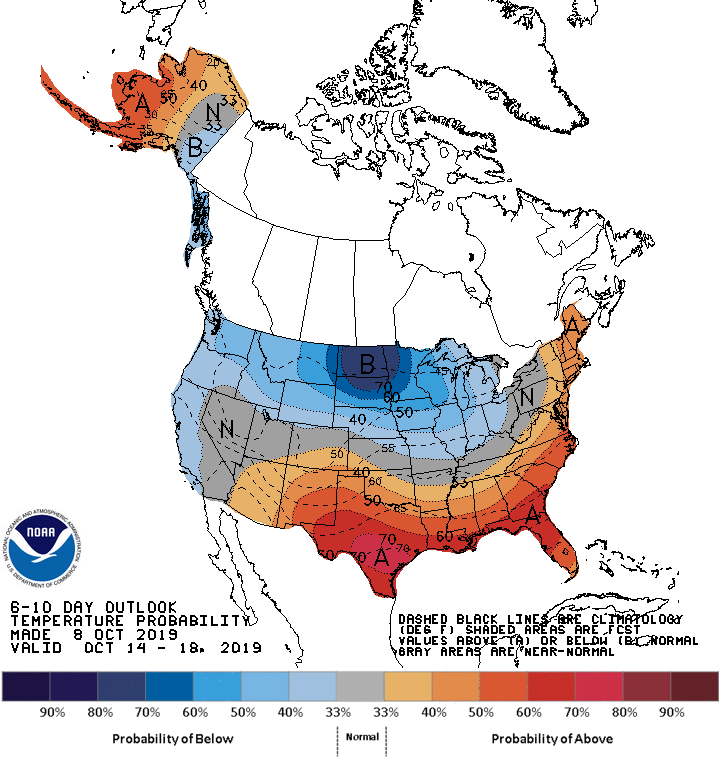
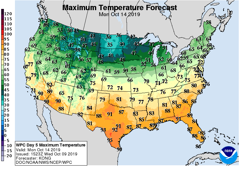
Looking ahead, the 6- to 10-day outlook calls for the likelihood of below-normal temperatures from the Pacific Northwest into the Midwest, while warmer-than-normal weather will prevail across much of the nation’s southern tier and along the Atlantic Seaboard.
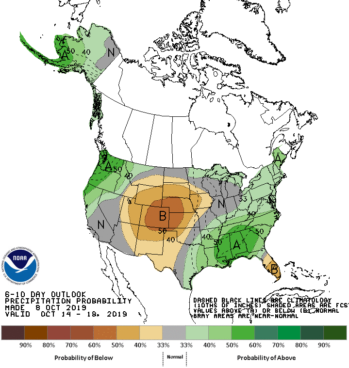
Meanwhile, near- or above-normal precipitation across most of the country, including the Southeast and Pacific Northwest, should contrast with drier-than-normal conditions across an area centered over central and southern sections of the Rockies and Plains.
Add Comment